The Atlantic Companion · Causeway Coastal Route · Antrim

Welcome to Cushendun & Torr Head.
We're glad you're here.

The slow road. From Ballycastle the main A2 swings inland to Cushendun, but the small road over Torr Head — single-track, hairpins, sheep on the tarmac — is the one to take. Cushendun itself is a National Trust village of Cornish-style cottages built by Lord Cushendun for his Cornish wife in the 1910s. The caves at the south end were the Stormlands shore in Game of Thrones. Torr Head, three miles north, is the closest point on the Irish coast to Scotland — twelve miles to the Mull of Kintyre, often visible enough to count houses. The stretch most visitors miss because the main road bypasses it.

Caves, white-washed cottages, and Scotland twelve miles across the channel.

Sharing from the Wild Atlantic Way

You're in Cushendun & Torr Head. Send it to someone who'd love it.

First things first

Where are you headed next?

Tell us once and we'll shape the rest of the page around it.

The essentials

What you shouldn't miss.

Locally chosen, not algorithmic. In rough order of "if you only do one thing".

Town

Cushendun village

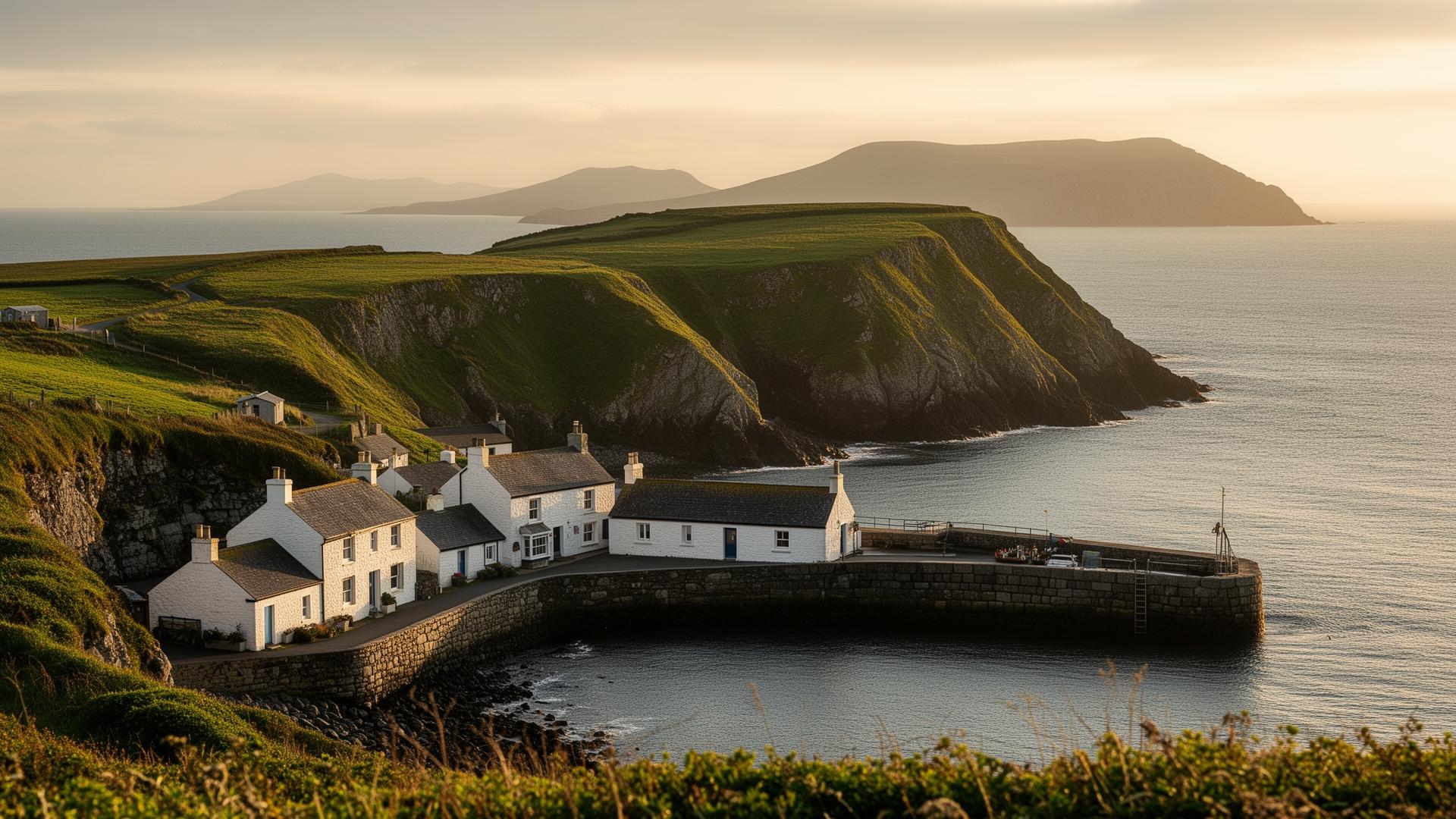
A planned conservation village built between 1912 and 1925 by Clough Williams-Ellis (later of Portmeirion fame) for Ronald McNeill, Lord Cushendun, in the Cornish vernacular his wife Maud knew from home. White-washed walls, slate roofs, a stone bridge over the Glendun river. Owned in trust by the National Trust. Walk it in 20 minutes.

Good to know · Free. Park at the village hall or at the beach. Mary McBride's pub on the corner has been a fixture for over a century.

Nature

Cushendun caves

Red sandstone sea caves at the southern end of the village beach, eroded over 400 million years. You can walk straight in at low tide. Used as the Stormlands shore in Game of Thrones (Melisandre's shadow-baby scene) but they would be remarkable without that.

Good to know · Free. Walk south along the beach from the village — five minutes. Care at high tide; check tides before going in.

View

Torr Head

A single-track road climbs to a 19th-century coastguard station on a 90-metre headland — the closest point in Ireland to Scotland, twelve miles across the Sea of Moyle. On clear days you can see houses on the Mull of Kintyre. Drive carefully — the road is a real road, not a viewpoint pull-in.

Good to know · Free. Signposted off the coast road north of Cushendun. Drive in low gear; the descent on the other side is steeper than it looks. Small car park at the head.

Town

Cushendall

Five minutes south of Cushendun — bigger village, the unofficial capital of the Glens, four roads meeting at a sandstone tower (the Curfew Tower, built in 1820 to imprison 'idlers and rioters'). A Saturday food market in summer; trad music in McCollam's. The natural overnight if Cushendun is too small for you.

Good to know · On-street parking around the tower. Tigh na Feide ('the house of the booley') by the Glenariff river is the local heritage centre.

History

Layd Church & MacDonnell graveyard

A roofless 13th-century church on a clifftop a mile north of Cushendall, surrounded by MacDonnell graves and Celtic crosses. The path down from the car park is steep but short. The view back up the coast to Garron Head is the reason locals walk here.

Good to know · Free. Small car park signposted from the coast road. Steep wooded path; sturdy footwear in wet weather.

Local businesses

Places we'd point a friend to.

Hand-picked, not paid for. The ferries, the beds, the pubs and the bike hire that make a visit work.

Before you go. These listings are compiled from public sources and aren't yet verified by the businesses themselves. Hours, menus and prices change with the seasons — always check directly with the venue before travelling, and book ahead in July and August. Owners can get in touch to update their listing.

Drink

Run a place in Cushendun & Torr Head?

Our directory is curated, not pay-to-play. If we'd recommend you, you can be on here.

See how to get listed

Got a window or a counter?

Download a free A5 QR card for Cushendun & Torr Head — print it, stick it up, and visitors land straight on the Cushendun & Torr Head guide.

Ask a local

The bits that aren't on Google.

Common questions

What people ask about Cushendun & Torr Head.

Is Cushendun worth visiting?

Yes — Cushendun is a tiny Cornish-style village (its terraces were designed by Clough Williams-Ellis of Portmeirion fame) on the Antrim Coast, with a pebble beach, the Cushendun Caves used as a filming location in Game of Thrones, and an unspoilt position at the mouth of Glendun. A natural stop between the Glens of Antrim and the Causeway Coast.

How do you drive to Torr Head?

Torr Head is reached by the narrow Torr Road that branches off the A2 just north of Cushendun. The road is single-track, very steep, with passing places — drive slowly and don't attempt it in a large vehicle. From the small car park at the headland it's a short walk up to the ruined coastguard station for the views to Scotland.

Can you see Scotland from Torr Head?

Yes — Torr Head is the closest point on the Irish coast to Scotland (the Mull of Kintyre is about 20 km north-east) and the Scottish coast is clearly visible on a good day. The same applies from Murlough Bay and Fair Head a few minutes further along the coast.

Were the Cushendun Caves in Game of Thrones?

Yes — the Cushendun Caves, on the foreshore beside the village, appear in Season 2 as the location where Melisandre gives birth to the shadow assassin. The caves are free to access on foot from the village. Allow about 30 minutes including photos.

Practical

The things you'll wish you'd known.

Fuel
Cushendall has a small filling station. Otherwise Ballycastle (25 min north) or Carnlough (25 min south).
Cash
ATMs in Cushendall. Most pubs and B&Bs take card; the village shop in Cushendun is cash-friendly.
Currency
Pound sterling (£).
Parking
Free in both villages. Torr Head has a small free car park at the top.
Phone signal
Patchy along the Torr road and over the moor. Reliable in the villages.
On the route
On the Causeway Coastal Route between Ballycastle and the Glens. Ballycastle 25 min north; Glenariff 20 min south.

Designed & developed by ideapath.app